
According to Chadds Ford Township Supervisors’ Chairman Frank Murphy, there are no plans to adopt an official map for the township, but the board is curious about the process.
“We want input even before deciding to go forward with an official map,” Murphy said.
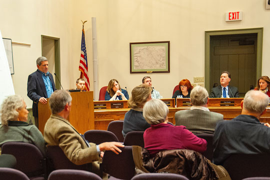
To that end Sam Haber of the Delaware County Planning Department gave a brief presentation on the what and why of such maps.
An official map is not just a map showing roads and properties. It’s also an ordinance that gives municipalities options on land preservation and the location of features designated for public use, Haber said.
The map and ordinance can apply to all or just part of the municipality and may show public streets, watercourse and identify areas earmarked for trails, sidewalks, parks and open space areas.
“The official map expresses a municipality’s interest in acquiring designated lands for public purposes sometime in the future,” according to Haber’s presentation. It can also be used to help implement parts of comprehensive or open space plans.
One of the aspects of the map is that it gives municipalities the option of asking property owners for certain considerations should the owners want to subdivide or develop the property that has features designated on the map. The municipality would then have up to a year to acquire that piece of the property.
Property can be acquired through a fee simple purchase, easement or eminent domain. However, Haber said an official map designation does not constitute a taking. The ordinance “only bestows negotiating power upon the township where public use of land may be beneficial to the public,” he said.
During a ranging conversation with members of the public, Haber said there were no municipalities in Delaware County that have adopted official maps, though two did consider doing so. He said nine or 10 municipalities in Chester County do have the maps.
Should township supervisors decide to adopt an official map, the process would take at least a year. There would need to be public meetings, development through the township Planning Commission and further review at the county level, as well as a public hearing.
About Rich Schwartzman
Rich Schwartzman has been reporting on events in the greater Chadds Ford area since September 2001 when he became the founding editor of The Chadds Ford Post. In April 2009 he became managing editor of ChaddsFordLive. He is also an award-winning photographer.