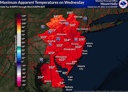
The National weather service is predicting excessive heat for the tri-state area through tomorrow.
“The next two days will feature the worst of this excessive heat episode, with widespread heat indices exceeding 100 degrees for several hours each afternoon. Heat indices will likely exceed 105 degrees in the urban corridor this afternoon, with forecast values very similar on Wednesday afternoon.”
Cooler air is expected to move in and linger through Friday. That cold front could bring thunderstorms, some of which may be severe. Heavy rain and localized flooding are possible.
 (No Ratings Yet)


Comments