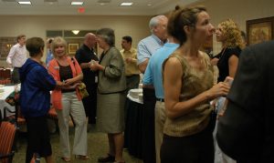
While rain grounded a demonstration of a drone in flight, members of the Chadds Ford Business Association had some ground schooling of how those unmanned aerial vehicles can be used for business.
Michael Mogavero, president of GooseView Technologies, told the group that the power in the technology is not the drone, but the data the drone can gather. And that data is more than just a simple photograph or video.
“It’s about getting data and turning that data into information so engineers can understand their assets,” he said. “The drone is just a tool to put a camera or sensor into a low altitude position.”
Data accumulated can show carbon, nitrogen, pollution, anything a scientist, engineer or maintenance person would want to know.

GooseView provides infrared thermographic imaging for clients in a variety of industries. Mogavero showed several 360-degree-videos of several work sites. One was a quarry in New Jersey, but the other showed a building site in the Chadds Ford Business Campus, the future headquarters of Franklin Mint Federal Credit Union, next to Hillman Drive.
Those videos, recorded by a drone flying specific patterns over a work site, provide images that can be put together in what Mogavero called a “3-D mesh capture” and can be viewed from different angles and elevations. He described the viewing experience as “inserting yourself into virtual reality.”
The drones Mogavero and his pilot, Paul Tauskey, use lock on to 17 different satellites so they always know their own exact location and can pinpoint GPS locations on the ground. Overlapping photos are taken and put together for a fully detailed image. Software can show the distance between two points and show the difference in elevation with accuracy of two to three centimeters, Mogavero said.
A 15-minute flight can provide as much data as a team of surveyors can after spending a day in the field, he said.
In addition to their use as surveying instruments, drones can be used to record storm damage and more. Mogavero said infrared imaging has been used in Africa to detect people with fevers in areas where the Ebola virus has been active.
The future of commercial drone use, as GooseView operates, is limited only by weather conditions and the advancement of technology. Mogavero speculated that it’s only a matter of time before ground-penetrating radar becomes small enough and light enough to be carried by drones to show what’s beneath the surface of an area being surveyed.
During a question and answer session several business owners asked about the legalities of flying drones. Mogavero said only pilots certified by the Federal Aviation Administration may operate drones used for commercial purposes, but there’s no such restriction for the hobbyist.
Restrictions that all drone operators must abide by include not flying over traffic or over people unless those people have some shelter. The FAA leaves privacy regulations regarding drone use up to the states and local municipalities.
About Rich Schwartzman
Rich Schwartzman has been reporting on events in the greater Chadds Ford area since September 2001 when he became the founding editor of The Chadds Ford Post. In April 2009 he became managing editor of ChaddsFordLive. He is also an award-winning photographer.
 (No Ratings Yet)
Comments