For area residents, it has become increasingly difficult to avoid treading on hallowed ground – mainly because the footprint of the Brandywine Battlefield continues to grow.
That increase has occurred in large part from the efforts of the Brandywine Battlefield Task Force. Formed in1993 with municipal, state, and federal representatives along with nonprofit institutions, it has been working to ensure that this integral part of American history gets the attention and preservation it merits.
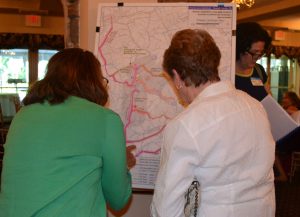
On Wednesday, June 29, officials from the Chester County Planning Commission hosted a festive event at the Radley Run Country Club to present the latest research on the battlefield and retreat areas to the townships where that activity occurred, including East Bradford, West Bradford, and Pocopson in Chester County and Chadds Ford, Thornbury, and Concord in Delaware County.
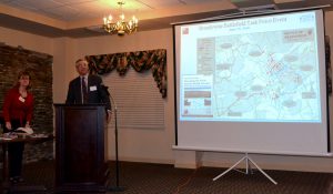
Addressing an enthusiastic audience of about 100, Brian O’Leary, executive director of the Chester County Planning Commission, explained that the research not only helps raise awareness of the importance of the battlefield but also enhances the area’s quality of life.
“Preservation won’t happen without advocacy and people pushing for it,” O’Leary said.
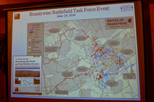
According to the 2013 Brandywine Battlefield Preservation Plan, the Sept. 11, 1777, battle highlights one of America’s most significant historical events, pitting General Howe and his well-armed professional army against the citizen soldiers led by General Washington for a daylong battle along the banks of the Brandywine Creek. Despite the loss, the Americans proved that they had talent and resiliency, which prompted assistance from the French. It also led the Americans to pursue a more effective defensive strategy.
The publications presented on Wednesday night were prepared by the Chester County Planning Commission with the assistance of the Commonwealth Heritage Group, formerly John Milner Associates. Funding came through a grant to Chester County from the Department of the Interior, National Park Service’s American Battlefield Protection Program (ABPP).
O’Leary noted that another reason to celebrate was the acquisition of additional funding. Thanks to the ABPP, troop movement and encampment areas in East Marlborough, Kennett, and Pennsbury townships and Kennett Square Borough would be studied.
Jeannine Speirs, a senior community planner for Chester County who chairs the Brandywine Battlefield Task Force, noted that the battlefield area spans 3,500 acres in 15 municipalities in two counties. But as the research has continued, so has the field of battle.
For example, two skirmishes were recently discovered in Westtown Township, and troop movements have been traced to New Garden Township and the state of Delaware.
Speirs said that planners hoped the identification of significant, historic locations would assist municipalities with land planning and conservation efforts, particularly since some of the key landscapes remain undeveloped.
Wade P. Catts from the Commonwealth Heritage Group, the evening’s keynote speaker, applauded the efforts of the Brandywine Battlefield Task Force. Catts, who provided an overview of the findings, said the comprehensive information that went into the publications could not have occurred without the input of many volunteers.
Catts explained that in accordance with ABPP guidelines, researchers employed KOCOA, a U.S. Armed Forces battlefield analytical technique. The acronym comes from key terrain, observation and fields of fire, cover and concealment, obstacles, and avenues of approach. Using this tool ensures a consistent baseline for battlefield analysis, Catts said.
He said such analysis enables researchers to anticipate what kind of artifacts might still exist in areas affected by the 17-mile trek by British troops and the subsequent battles. For example, the fact that residents of what is known as the Craig farm at Oakland and Harvey roads in Chadds Ford Township reported finding 150 musket balls is not surprising.
Catts ended with a quote from a 2007 study by the National Park Service: “The more a historic site is recognized, documented, interpreted, and made accessible, the more likely it is to be protected in the long term.”
To access the publications presented at Wednesday night’s events as well as additional information about the Brandywine Battlefield, go to http://www.landscapes2.org/publications/PubHistoric.cfm.
 (3 votes, average: 5.00 out of 5)
Comments